Mobile Bay Hydrodynamics Model#
In the video:
The video does not have sound
The starting screen is Google Earth, with a view from space showing the North America side of Earth.
It zooms in to the Gulf of Mexico, then further zooms in to Mobile Bay.
Borders, cities and road maps are turned on.
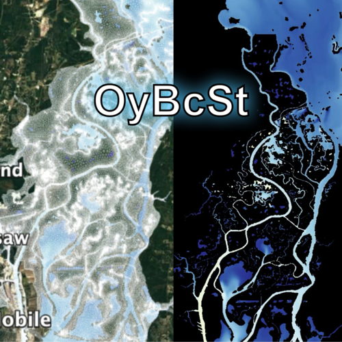
The left half of the screen shows Mobile Bay on Google Earth, and the right half shows a model animation of temperature for the same area.
On the left, the SCHISM grid is overlaid on Mobile Bay, while the animation on the right continues to play.
Both images are zoomed in to the Mobile-Tensaw River Delta.
The images on each size zoom to the location of Dauphin Island.
There is a radial swipe to Dauphin Island with the SCHISM grid overlain, which further zooms to Dauphin Island Sea Lab(DISL).
There is a frame flip to a Google Earth 3D map pedestrian view to the parking lot and entrance of DISL, showing signs for DISL and Alabama Aquarium.